Standing in the presence of an ageless wonder ... a first-timer’s impression of the ‘Mighty Kaieteur’
Written by Clifford Stanley
Monday, 17 October 2011 02:55
Source - Guyana Chronicle
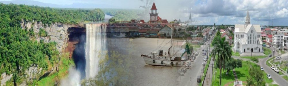
 A FEW Sundays ago, I made my first visit to the timeless, awe-inspiring Kaieteur Falls; and I couldn’t help the overriding impression that I was in the presence of a rare antiquity, a sort of surreal entity that was thousands, nay, millions of years old. This was a rather humbling thought, given the paltry threescore and 10 years I can reasonably look forward to, should I be that lucky.
But that somewhat desolate feeling was soon relieved by a dawning realisation that I ought to be proud of the privilege of being born in a country that is host to one of nature’s many wonders.
Yes! This was Guyana’s very own waterfall; the jewel in our crown; our own inimitable landmark that commands international attention!
And as I perused the huge rocks and the mighty swell of the Potaro River plummeting with irresistible force into the gorge below, I inched cautiously forward, trying to see to the bottom of the chasm, even as thoughts of what little I know about the geology of Guyana swirled in my head.
The constant of change
As I stood there, I considered how the process of the Kaieteur Falls coming into being defies imagination, even from its origins in the Pre-Cambrian period very deep back in time.
Geologists have affirmed that the place where I stood beside this incredible flow on a Sunday morning in 2011, was nowhere in existence in the Pre-Cambrian period (Paleo-Proterozoic) 1.9 billion years ago.
The only way I could have been in this exact spot, if that were remotely possible, was if I were in a boat, since where Kaieteur Falls now stands was once a huge, inland sea extending westwards into the then non-existent Venezuela.
There were no fishes in that sea either. One thousand, nine hundred million years ago, there were no fish around; just algae, tons of green, scummy stuff literally covering the surface of that sea. There were, also, no other forms of life in existence.
At that time, there were mountains located northeast of where Kaieteur Falls now stands; huge gray behemoths rearing several thousand feet into the lonely skies. They looked invincible, but geological history shows that they were doomed to extinction by the inevitable force of erosion.
Indeed, as eons passed, we are told, the mountains in the high northeast eroded, losing their stature to denudation by wind, water and rain, perhaps by an inch every thousand years.
As they wasted away, they shed segments into this ancient sea ever so slowly, eventually becoming what we now call ‘The Greenstone Belt’. And, bit by bit, hundreds of thousands of years at a time, out of this ancient sea arose the Pakaraima Mountains, source of the Potaro River that flows into the Kaieteur Gorge.
Expert opinion
I obtained expert opinion on these statements as I was writing this article. Dr. Serge Nadeau, senior geologist at the Guyana Geology and Mines Commission (GGMC), confirmed the theory about the ancient mountains in the northeast of the Pakaraimas, and their role in the formation of this range and subsequently Kaieteur Falls.
He disclosed that a team of geologists was for three years engaged in a geological mapping exercise in the Pakaraimas in the 1970s. Their survey included the Kaieteur Top.
He had this to say of the survey: “At Kaieteur Top there are conglomerate rocks with pebbles in them. The erosion of the pebbles in most conglomerates shows the direction of flowing water in the geological past.
“From the orientation of the erosion of these rocks, the geologists saw that the direction of the flow of the paleo current was from the northeast.
“So, everything that formed the Pakaraimas and the mountains in the neighbouring area of Venezuela, Mount Roraima included, was coming from the northeast.
“Even the gold that the people are mining within the Pakaraimas, or at the foot of this range, is from materials transferred from these eroding mountains of 1.9 billion years ago,” he said.
Nadeau said the Kaieteur Plateau and the Pakaraima Mountains are lower than those mountains formed on the Venezuelan side close to the Guyana/Venezuela border.
The Tepuis or Table Top Mountains there, including Mount Roraima, have resulted because the historical geological processes were much higher, even though the mountains were developed by the same method.
And, of course, most of us know that the Potaro River – in reality the Kaieteur Falls – has its source in the highest mountain in the Pakaraimas, which is wholly and solely in Guyana: Mount Ayanganna.
Myth and mystery
On my recent visit to the area, I found that many people who view the grandeur of Kaieteur Falls develop and sometimes articulate their own perspective on the phenomenon.
One female visitor summed up her views in one word: “Massive!”
“Look at those two rocks!” another visitor said to me whilst pointing to a spot in the valley.
His finger indicated a huge rock, round in shape, with some shrubbery and looking very much like a human head with a straw hat on it.
“Yes! I see it!” I said.
“That,” my fellow visitor said, “is the head of Old Kaie with his hat still on.”
He grinned and then said: “Now look next to it: Do you see that long canoe-shaped rock?
“Yes! And so?”
“That, my friend,” he said, pointing to the canoe-shaped rock, “is the boat Old Kaie was in when he went over the edge of the Falls in a sacrificial attempt to protect his tribe from a rival Carib tribe by means of divine intervention.”
As I stood there, somewhat mesmerized by it all, somebody else pointed to the rocks on the opposite side and asked if I could see the face on it.
I quite agreeably complied and looked.
I didn’t see anything …
“Look closely and you will see the two eyes and the nose and the mouth cut out into the rocks!”
I stared hard, but still couldn’t see it.
Looking at me somewhat suspiciously, perhaps as if I were a bit denser than expected, the fellow gave up and walked away, looking back only once, and that fleetingly, as if wondering from whence I had come.
Theories
Maybe you, dear reader, may have better luck than me when you make the visit to the Kaieteur Falls.
In a way, though, I think I may have a handle on this theorizing.
My tentative theory is that we, as human beings, are ceaselessly classifying things around us, trying to place observable phenomena into categories that we already know.
If we cannot find a category for something that we hear while walking down the road at mid-night, we are likely to show the proverbial ‘clean pair of heels’.
But something as big and as primeval as the Kaieteur Falls is very difficult to classify as per our standards.
So, I guess that we, frail humans, have tried and will keep trying to place the timeless Kaieteur Falls into some category that we can relate to, even though we will forever come up short.
Geologically, though, Kaieteur is slowly retreating.
Formed by the Potaro with its source in Mount Ayanganna, the force of the Falls is slowly eroding the precipice.
Erosion never takes a break.
Geologists say that the waterfall was much farther west when it was formed, but has been retreating slowly and imperceptibly, due to the erosive force of the water going over the edge.
They opine that one hundred thousand years from now, this waterfall will have so eroded its edge that the Potaro may become a flat river.
But that is a hundred thousand years from now.
I, with my puny lifespan of at most threescore years and 10, confess that I find it extremely difficult to think about the implications of such a development.
All I can say at this time is that my trip to the brink of the Kaieteur Falls impressed upon me a humbling and mind-numbing experience.
Written by Clifford Stanley
Monday, 17 October 2011 02:55
Source - Guyana Chronicle
A FEW Sundays ago, I made my first visit to the timeless, awe-inspiring Kaieteur Falls; and I couldn’t help the overriding impression that I was in the presence of a rare antiquity, a sort of surreal entity that was thousands, nay, millions of years old. This was a rather humbling thought, given the paltry threescore and 10 years I can reasonably look forward to, should I be that lucky.But that somewhat desolate feeling was soon relieved by a dawning realisation that I ought to be proud of the privilege of being born in a country that is host to one of nature’s many wonders.
Yes! This was Guyana’s very own waterfall; the jewel in our crown; our own inimitable landmark that commands international attention!
And as I perused the huge rocks and the mighty swell of the Potaro River plummeting with irresistible force into the gorge below, I inched cautiously forward, trying to see to the bottom of the chasm, even as thoughts of what little I know about the geology of Guyana swirled in my head.
The constant of change
As I stood there, I considered how the process of the Kaieteur Falls coming into being defies imagination, even from its origins in the Pre-Cambrian period very deep back in time.
Geologists have affirmed that the place where I stood beside this incredible flow on a Sunday morning in 2011, was nowhere in existence in the Pre-Cambrian period (Paleo-Proterozoic) 1.9 billion years ago.
The only way I could have been in this exact spot, if that were remotely possible, was if I were in a boat, since where Kaieteur Falls now stands was once a huge, inland sea extending westwards into the then non-existent Venezuela.
There were no fishes in that sea either. One thousand, nine hundred million years ago, there were no fish around; just algae, tons of green, scummy stuff literally covering the surface of that sea. There were, also, no other forms of life in existence.
At that time, there were mountains located northeast of where Kaieteur Falls now stands; huge gray behemoths rearing several thousand feet into the lonely skies. They looked invincible, but geological history shows that they were doomed to extinction by the inevitable force of erosion.
Indeed, as eons passed, we are told, the mountains in the high northeast eroded, losing their stature to denudation by wind, water and rain, perhaps by an inch every thousand years.
As they wasted away, they shed segments into this ancient sea ever so slowly, eventually becoming what we now call ‘The Greenstone Belt’. And, bit by bit, hundreds of thousands of years at a time, out of this ancient sea arose the Pakaraima Mountains, source of the Potaro River that flows into the Kaieteur Gorge.
Expert opinion
I obtained expert opinion on these statements as I was writing this article. Dr. Serge Nadeau, senior geologist at the Guyana Geology and Mines Commission (GGMC), confirmed the theory about the ancient mountains in the northeast of the Pakaraimas, and their role in the formation of this range and subsequently Kaieteur Falls.
He disclosed that a team of geologists was for three years engaged in a geological mapping exercise in the Pakaraimas in the 1970s. Their survey included the Kaieteur Top.
He had this to say of the survey: “At Kaieteur Top there are conglomerate rocks with pebbles in them. The erosion of the pebbles in most conglomerates shows the direction of flowing water in the geological past.
“From the orientation of the erosion of these rocks, the geologists saw that the direction of the flow of the paleo current was from the northeast.
“So, everything that formed the Pakaraimas and the mountains in the neighbouring area of Venezuela, Mount Roraima included, was coming from the northeast.
“Even the gold that the people are mining within the Pakaraimas, or at the foot of this range, is from materials transferred from these eroding mountains of 1.9 billion years ago,” he said.
Nadeau said the Kaieteur Plateau and the Pakaraima Mountains are lower than those mountains formed on the Venezuelan side close to the Guyana/Venezuela border.
The Tepuis or Table Top Mountains there, including Mount Roraima, have resulted because the historical geological processes were much higher, even though the mountains were developed by the same method.
And, of course, most of us know that the Potaro River – in reality the Kaieteur Falls – has its source in the highest mountain in the Pakaraimas, which is wholly and solely in Guyana: Mount Ayanganna.
Myth and mystery
On my recent visit to the area, I found that many people who view the grandeur of Kaieteur Falls develop and sometimes articulate their own perspective on the phenomenon.
One female visitor summed up her views in one word: “Massive!”
“Look at those two rocks!” another visitor said to me whilst pointing to a spot in the valley.
His finger indicated a huge rock, round in shape, with some shrubbery and looking very much like a human head with a straw hat on it.
“Yes! I see it!” I said.
“That,” my fellow visitor said, “is the head of Old Kaie with his hat still on.”
He grinned and then said: “Now look next to it: Do you see that long canoe-shaped rock?
“Yes! And so?”
“That, my friend,” he said, pointing to the canoe-shaped rock, “is the boat Old Kaie was in when he went over the edge of the Falls in a sacrificial attempt to protect his tribe from a rival Carib tribe by means of divine intervention.”
As I stood there, somewhat mesmerized by it all, somebody else pointed to the rocks on the opposite side and asked if I could see the face on it.
I quite agreeably complied and looked.
I didn’t see anything …
“Look closely and you will see the two eyes and the nose and the mouth cut out into the rocks!”
I stared hard, but still couldn’t see it.
Looking at me somewhat suspiciously, perhaps as if I were a bit denser than expected, the fellow gave up and walked away, looking back only once, and that fleetingly, as if wondering from whence I had come.
Theories
Maybe you, dear reader, may have better luck than me when you make the visit to the Kaieteur Falls.
In a way, though, I think I may have a handle on this theorizing.
My tentative theory is that we, as human beings, are ceaselessly classifying things around us, trying to place observable phenomena into categories that we already know.
If we cannot find a category for something that we hear while walking down the road at mid-night, we are likely to show the proverbial ‘clean pair of heels’.
But something as big and as primeval as the Kaieteur Falls is very difficult to classify as per our standards.
So, I guess that we, frail humans, have tried and will keep trying to place the timeless Kaieteur Falls into some category that we can relate to, even though we will forever come up short.
Geologically, though, Kaieteur is slowly retreating.
Formed by the Potaro with its source in Mount Ayanganna, the force of the Falls is slowly eroding the precipice.
Erosion never takes a break.
Geologists say that the waterfall was much farther west when it was formed, but has been retreating slowly and imperceptibly, due to the erosive force of the water going over the edge.
They opine that one hundred thousand years from now, this waterfall will have so eroded its edge that the Potaro may become a flat river.
But that is a hundred thousand years from now.
I, with my puny lifespan of at most threescore years and 10, confess that I find it extremely difficult to think about the implications of such a development.
All I can say at this time is that my trip to the brink of the Kaieteur Falls impressed upon me a humbling and mind-numbing experience.